Turning the real world into digital assets

summary
Workflow shows how drones, cameras, laser scanners, GNSS stations and turntables combine with RealityCapture and Unreal Engine to turn places and objects into usable assets. Examples include 10,000 images and 50 laser scanners for a castle interior/exterior, a 72 m-deep shipwreck reconstructed from thousands of diver-shot photos, six peaks at ~2,500 m for VR, and a city scan using ~100,000 images that starts as ~10 billion polygons before manual optimization. Practical tips cover raw over JPEG, 80% overlap, 30° angle and mixing laser geometry with photo texturing.
AI-written summary · about
chapters (15)
- 0:00Introduction
- 2:42Photogrammetry equipment & quality
- 5:11Photogrammetry overlap & angles
- 7:05Capturing landscapes & buildings
- 9:47Laser + photogrammetry
- 11:36Cultural heritage digitization
- 15:40VR AR touch apps
- 18:21Georeferenced data accuracy
- 20:37Small object scanning
- 20:59Cave underwater mountain scans
- 23:45Storytelling in reconstructions
- 24:05Underwater shipwreck scans
- 26:38City scans & digital twins
- 29:44Optimizing city scans
- 30:34Small objects in large scans
related talks
 11mMaximizing Efficiency and Minimizing Costs with Unreal Engine
 58mVFX Workflow for Real-Time Production with Photogrammetry, Alembic, and Unity
 20m"Rebirth": Leveraging Scan Data in UE4
 05mHOK Uses UE4 and 3D Repo for Centre Block Project
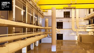 26mHow Unreal was Used in the Design of the World's Most Advanced Research Facility for Neutron Science
 12mReality Capture & Visualization for Treehouse Design
 27mWorking Smart - Machine Learning in Art Asset Creation for the Games Industry
 32mGamification of Transport and Infrastructure Engineering