Spatial Analysis and the Geoweb
summary
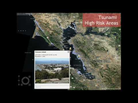
A cloud GIS called ArcGIS Online exposes map services, tiled base maps and APIs so developers mash up authoritative imagery, USGS/topographic tiles and OpenStreetMap layers, with iPhone app and Silverlight clients that already load live services. The system lists about 50,000 servers and registers roughly 300,000 user organizations, lets users combine map services, save maps and publish apps, and shows working examples—crime maps, animated Chile earthquake layers, and a citizen pothole report workflow that posts into municipal GIS.
AI-written summary · about
chapters (8)
- 0:00Introduction to web GIS
- 1:00The evolving GIS architecture
- 2:01Crowdsourcing and integration
- 3:25The ArcGIS system concept
- 6:15Demonstrating map interactivity
- 11:29Exploratory tools and apps
- 13:45Integrating open government
- 16:45Citizen engagement and future
related talks
 10m"ArcGIS and the Web: Better Sharing of Geographic Information"
 12mGeoEnabling Gov 2.0
 12mOpen Data and the Future of ...
 19m"Realizing Spatial Intelligence on
 15mInterviewed at Gov 2.0 – Jack Dangermond
 42mOpen Data & Maps As Tools for More Impact
 17mWho actually uses geospatial data?
 16mJack Dangermond interviewed at Gov 2.0 Summit 2010