SDI and geographical research in French Polynesia
summary
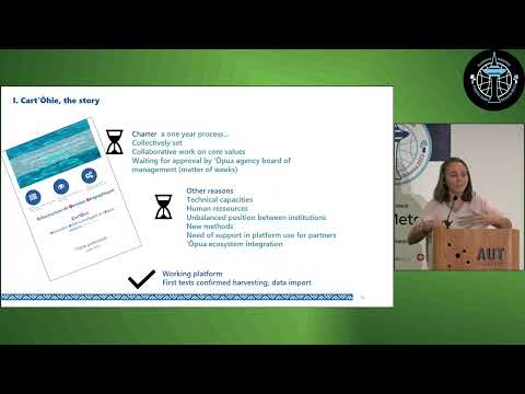
A Spatial Data Infrastructure is deployed for French Polynesia using GeoNode + mViewer on a locally hosted instance (GeoNode 4.1.2) and open‑source tooling, tested with OPA data and working in pilot imports from a social housing operator. Governance is set by a community charter (15 organizations, ~30 active contributors) and a light steering model while technical capacity runs at ~0.25 FTE and unreliable internet. Data representation experiments use a hex grid for 118 islands across 5 archipelagos to handle complex administrative layers.
AI-written summary · about
chapters (9)
- 0:00Introduction to project
- 1:05About OPA agency
- 3:32SDI project context
- 5:42Governance and charter
- 8:42Technical challenges
- 10:29Core values and collaboration
- 12:45Geographical data representation
- 15:16Next steps and pilots
- 18:30Acknowledgments and Q&A
related talks
 23mFeedback on a new OSM movement in French Polynesia
 23mFOSS4G Pasifika Roadmap: Then/Now/Beyond
 28mInspiring the Next Generation My Journey in Open Source and Community Build
 22mMap-based tools for Māori communities
 18mThe future of open data
 13mDemocratising Open (Geo)Data for Open Innovation and Solutioning
 18mWhy Geospatial Data is Infrastructure
 19mWhen data can't be open