What is Digital Earth Pacific

summary
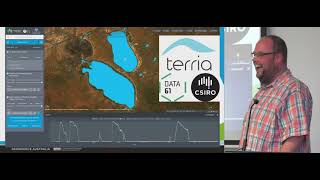
Digital Earth Pacific builds an operational Earth‑observation platform for the Pacific with a three‑phase rollout: governance and tech foundation, capacity development across 22 member states, then operational product delivery. It ingests analysis‑ready cloud‑optimized data (Landsat back to the 1980s, Sentinel‑2 at 10 m, Sentinel‑1 SAR), produces alpha products — coastal mean‑annual waterlines 2000–2022 at 30 m, mangrove extent from Global Mangrove Watch, annual water‑frequency maps — served via WMS/WMTS/tiles and visualized with Terria. Processing uses Jupyter notebook server (32–500 GB), Docker and Argo; initial needs assessments sample four countries and a Tonga workshop collected ~3,000 field points.
AI-written summary · about
chapters (6)
- 0:00Introduction to Digital Earth Pacific
- 1:46Program mission and strategy
- 9:06Needs assessment and use cases
- 14:49Launch products demonstration
- 22:17Next steps and platform goals
- 23:44Q&A session
related talks
 16mThe Open Data Cube and working towards a Digital Earth
 05mCoastal Waters Utilizing GIS & RS techniques
 19mTime and tide. Mapping the changing 3D shape of Australia’s coastline using p
 14mSatellite data monitoring for analytical models
 21mAquawatch Data Systems a cloud solution for water quality monitoring and forecasting
 34mGeoscience Big Data Computing with Python
 24mEnvironmental Monitoring with Large-Scale Land Cover Classification
 39mSatellite Imagery to Machine-Readable Intelligence