GeoAI: Evolution of AI-Based Tree/Vegetation Detection Models Using Imagery

summary
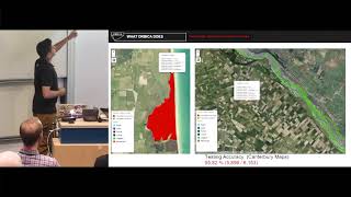
AI pipelines detect trees from drone, aerial and Sentinel-2 imagery using CNNs and fine‑tuning, produce 5M urban and 50M rural tree geometries, and deploy results as API/tiles; built a New Zealand analysis‑ready Sentinel data cube, ran inference on two Titan V GPUs (country run ~15h then geoprocessing in Postgres reduced it to ~3h). Models hit 94% accuracy urban, 89% rural, drone species at ~85% species accuracy, and Sentinel-2 countrywide 86% F1 79% species, but require heavy postprocessing for tile artifacts, false positives, and vector scaling.
AI-written summary · about
chapters (15)
- 0:00Introduction and background
- 1:25Ora's geospatial AI platform
- 2:27Evolution of imagery sources
- 3:49Aerial imagery models
- 7:21Handling AI model results
- 8:45Client feedback and iteration
- 10:48Human validation process
- 11:30Drone imagery challenges
- 13:35Satellite imagery for nationwide models
- 16:24Countrywide model validation
- 18:51Postprocessing and optimization
- 19:33Comparison of imagery types
- 21:19Emerging geospatial AI models
- 22:44Validation tools and client collaboration
- 23:51Q&A session
related talks
 41mAbby Seneor | AI Track | Compass AI & Data Summit 2025
 36mWatching Millions of Trees with Python: For Impact and Profit
 48mTaking the planet’s pulse: AI to empower adaptation to global change
 27mSmart Forestry: AI in the Service of Nature
 17mGeoAI: a feature extraction tool set using Tensor Flow and Keras...
 36mClassification of Satellite Imagery
 18mGeospatial AI: Where Can AI Help to Tackle Today’s Real-World Challenges?
 11mUsing AI to Accelerate the Smart Green Transition