OpenStreetMap - Balancing structure with grassroots mapping

summary
Discussion compares concrete practices: TomTom adopts OpenStreetMap and produces a combined map within a year, HOTOSM tasking manager highlights urgent hotspots and needs validators, and about 30% of places change each year so local confirmation is essential. Practical tools named: ID editor presets, JOSM, RSS/filters for monitoring edits, and mapathon performance issues that block scaling. Case studies include Afghanistan tasks, localized Bahasa Indonesia wiki and government uptake that sometimes uses but does not contribute back.
AI-written summary · about
chapters (11)
- 0:00Introduction to panel
- 1:00Panel format and goals
- 3:00Local OSM chapters and governance
- 10:15Audience poll on OSM edits
- 11:20Lessons from other open data communities
- 14:08Tagging schema challenges
- 23:49Urgent mapping needs and support
- 30:07Overture Maps Foundation impact
- 32:33Protecting sensitive cultural data
- 37:50Convincing management to trust OSM
- 47:23Government responsibilities with OSM
related talks
 45mThe OpenStreetMap Project = Data + Community
 14mBuilding OpenStreetMap Validation Processes in the Open
 32mThe OpenStreetMap Community
 40mHow do you harness crowd sourcing for a community that also delivers for business?
 21mExploring OSPOs and Open Methods in Humanitarian Response
 14mHOT Tasking Manager: The Road Ahead
 06mImproving OpenStreetMap Data Quality: Me & You
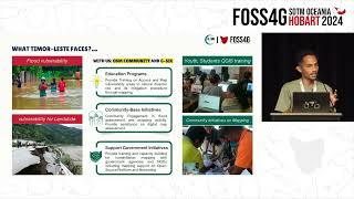 06mInnovative Approaches to Anticipatory Mapping in Bobonaro, Timor Leste