Map-based tools for Māori communities
summary
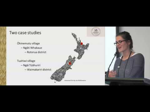
A prototype web app maps and timelines Māori place-based knowledge into planning by letting communities upload raster and vector layers, attach media-rich story-mapped cultural narratives, and draw geographies tied to timeline events. Tech stack uses Vue.js client, OpenLayers, GeoServer APIs, Django backend, PostgreSQL/PostGIS and Docker. A governance model implements a kaitiaki validation workflow so storytellers submit drafts for kinship-group approval. Two village case studies drive requirements; community user testing is scheduled for early December.
AI-written summary · about
chapters (14)
- 0:00Map-based tools for Māori communities
- 0:43Collaborative spatial planning tools
- 2:40Two case studies
- 3:25Research question
- 4:14Place-based bicultural tool
- 5:06Cultural narratives of the villages
- 6:05Base prototype progress
- 9:30Nested structure of governance
- 10:16Ohinemutu organigram
- 10:50Tuahiwi organigram
- 11:35Technological stack
- 12:54DB model
- 14:02Why using FOSS?
- 14:41Future steps
related talks
 45mMapping the Future: The Intersection of Geospatial, Open Source, and Open Data
 01h 34mBuild a Web Map with Open Source Tools
 26mMapping for impact: Scaling social good with DataKind and Mapbox
 13m"Indigenous Mapping: Emerging Cult
 28mThe art of place: Maps that merge design, data, and discovery
 48mSaving Gaia with jQuery Mobile and GeoDjango
 20mBuilding maps with Impact on React and the Jamstack
 30mStreamlined Map Development: Part 1