FIXME: Documenting the Uneven Distribution of OSM Data Quality Issues

summary
Analysis of 1.7 million fixmes in OpenStreetMap uses OSM exports, a Python LangDetect filter, and Labeled LDA with geographically stratified cross‑validation (US split by census regions, Australia). Imported bulk edits were removed. About 73% of fixmes map to ISO quality classes (completeness, positional accuracy, non‑quantitative and quantitative attribute accuracy); completeness rises in western/southern US while non‑quantitative attribute errors dominate Australian OSM. Results inform which error types to target for automated healing.
AI-written summary · about
chapters (8)
- 0:00Introduction to project
- 1:31Self-healing maps concept
- 2:36Human immune system metaphor
- 5:47Understanding OSM problems
- 8:40Geographical analysis of fixmes
- 13:02ISO standard quality categories
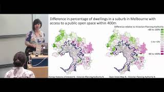
- 15:54Common topics and VicMap comparison
- 18:00Conclusion and future steps
related talks
 14mBuilding OpenStreetMap Validation Processes in the Open
 13mDoes our choice of open data sets matter...
 01h 29mImproving Open Data Quality using Python
 06mTracking OpenStreetMap History and Quality with the ohsome Stack
 16mBuilding Heights: From Open USGS lidar to open Overture maps
 01h 41mOpenStreetWhat? Mapping The World With Open Data
 50mMaking use of OpenStreetMap data with Python
 37mWorking with Maps: Extracting Features for Traffic Crash...