Does our choice of open data sets matter...
summary
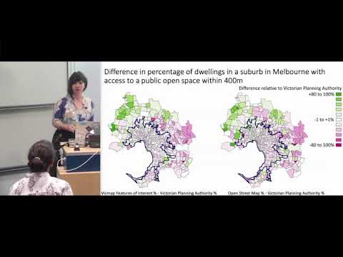
Compares three open datasets to measure the policy metric of dwellings within 400 m of public open space: Victorian Planning Authority (gold standard, 2017, incomplete coverage), Vicmap Features of Interest (statewide, updated annually) and OpenStreetMap (polygons, ~100 inconsistent tags). For Greater Melbourne results are 88% (VPA), 87% (Vicmap) and 81% (OSM); major urban areas about 90%—all below the 95% policy target. Discrepancies stem from tagging gaps, update lag (new Werribee park absent from VPA) and poorer OSM coverage in outer suburbs.
AI-written summary · about
chapters (6)
- 0:00Start
- 0:57Why measure access to public open space
- 3:44Creating 'public open space' datasets
- 4:42Measuring access
- 8:43Causes of differences
- 11:42Questions
related talks
 16mLibrary Map: how generous is your open data?
 22mUnderstanding our cities with FOSS4G
 19mWhere's your hood at? Crowdsourcing Neighbourhoods using Open Source Tools
 21mFIXME: Documenting the Uneven Distribution of OSM Data Quality Issues
 01h 41mOpenStreetWhat? Mapping The World With Open Data
 50mLet's play with Brno Data
 52mMapping a Path to Digital Democracy: A Federal Perspective
 40mHow to measure a city