State of TerriaJS
summary
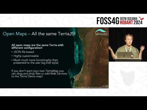
TerriaJS is a browser‑only TypeScript React app layered on Cesium and Leaflet that supports over 50 Web APIs and file formats, runs as a static-site deployable client, and powers National Map with ~14,000 federated datasets (data stays on source portals). Recent work upgrades Cesium to 1.11 with 3D Tiles Next and Google 3D mesh support, adds clipping boxes, COG and ArcGIS server viewers, direct Ion imports and experimental plugin support, plus documentation, catalog editor prototypes and a planned UI overhaul.
AI-written summary · about
chapters (9)
- 0:00Introduction to TerriaJS
- 1:05What is TerriaJS
- 3:53Technical foundations
- 5:40Open data maps
- 8:08Storytelling with maps
- 11:59New features in TerriaJS
- 16:18Documentation and community
- 17:41Future plans
- 19:28Q&A
related talks
 19mTerriaJS: An open-source framework for 3D geospatial data...
 05mCloud Optimised Geotiffs in TerriaJS
 20mA semantic terrain engine
 29mCreating 3D web maps with Cesium
- 29mCreating 3D web maps with Cesium
 25mDigital Twins with TerriaJS and Magda
 30mA front-end dev epic journey into geography
 34mTerraformer Open Source Geometry for Javascript