A front-end dev epic journey into geography

summary
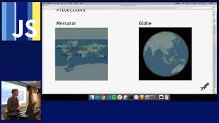
Chronicle of web cartography that names actual tools and outcomes: history of longitude and web Mercator that puts Earth in a square with Greenland appearing ~7× too large; tiles as 256px image grids and the planet file at ~1 terabyte; Leaflet described as the jQuery of maps while GeoJSON, PostGIS and Overpass power workflows; CB builds an open source online editor, uses vector tiles rendered client‑side with SVG/D3 atop raster basemaps and Mapbox now pushes a WebGL client.
AI-written summary · about
chapters (11)
- 0:00Intro
- 0:21Eriks background
- 3:47Eriks Twitter
- 3:57Map Tiles
- 6:22Projections
- 9:24Latitude and Longitude
- 11:10OpenStreetMap
- 14:05Data Visualization
- 16:28Leaflet
- 19:35Carter CSS
- 26:19Conclusion
related talks
 01h 34mBuild a Web Map with Open Source Tools
 27mCartography on the Web
 18mBuilding Maps with Impact on React and the JAMstack
 37mSlippy Map Style: Geo-canvas design with CartoCSS
 49mSaving the world with JavaScript: A Data Visualization story
 25mMapping diplomacy: Visual storytelling for global impact
 46mDiscovering 40 Geo-APIs in 40 Minutes
 02h 02mInteractive 3D Web Mapping