Cloud and Shadow Recognition in Satellite Imagery
summary
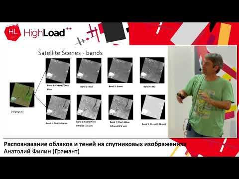
Describes detection of clouds and cloud shadows in Landsat-8 satellite imagery, comparing traditional methods like Fmask (which need careful parameter tuning and rely on the problematic TIRS thermal band) and discussing their failures on thin high-altitude clouds. Presents approaches to automatically flag or discard contaminated scene areas early in processing to improve land-surface monitoring and analysis.
AI-written summary · about
chapters (11)
- 0:00Introduction
- 3:12Satellite imagery problems
- 11:12Traditional cloud masking
- 15:24Neural networks approach
- 17:32Training data challenges
- 21:57Network architecture
- 25:50Better training methods
- 29:15Atmospheric correction impact
- 31:30Results and errors
- 35:49Takeaways and future work
- 40:04Q&A
related talks
 36mClassification of Satellite Imagery
 46mDeep Learning for Satellite Image Processing, Lessons Learned
 18mDetection of solar panels based on aerial images of the city of...
 48mTaking the planet’s pulse: AI to empower adaptation to global change
 22mObject Segmentation in Satellite Imagery (Kaggle DSTL)
 33mWhat and where? - Machine learning for geospatial image analysis
 31mFrom Radar Echoes To Real-Time Recognition: Deep Learning on Another Planet -An Open Source Workflow
 19mDigital Earth Pacific DEP cloud native approaches to detect mineral extraction