Large Scale Field Delineation

summary
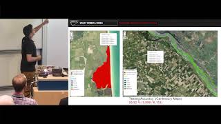
Uses encoder‑decoder models (ResUNet34 backbone) on Mapbox imagery with three targets: boundary, extent, distance masks; trains on RPG and internal annotations with transfer learning and weakly supervised learning, matching pixel scales by mixing zoom levels 13/14. Adds a tiny fine‑tune on French data to teach negatives, postprocesses predictions with watershed segmentation plus size thresholds, and stitches tiles by expanding to 2×2 neighbors. Field‑level metrics are high; boundary metrics remain low by construction but the pipeline scales to state‑sized areas.
AI-written summary · about
chapters (17)
- 0:00Large-scale field delineation intro
- 1:55Field delineation for agriculture
- 3:20Field boundary prediction data
- 8:17Aerial imagery sources for training
- 9:42Model training with masks
- 11:05Domain shift French vs American data
- 15:39Weekly supervised learning
- 17:27Fine-tuning negative annotations
- 20:16Over-segmentation vs under-segmentation
- 21:20Post-processing watershed
- 25:15Scaling tile predictions
- 31:20Conclusion and future work
- 32:46Q&A seasonality and stitching
- 34:16Q&A RPG dataset limits
- 36:05Q&A fine-tuning impact
- 38:35Q&A input features
- 39:39Q&A data augmentations
related talks
 21mLand Boundary Delineation using U-Nets
 01h 36mFrom Maps to Models: An End-to-End Journey in Geospatial Machine Learning with Python
 31mFrom Radar Echoes To Real-Time Recognition: Deep Learning on Another Planet -An Open Source Workflow
 36mClassification of Satellite Imagery
 15mTowards automated mapping of pedestrian path networks at scale
 07mMapping Urban Deprivation
 33mWhat and where? - Machine learning for geospatial image analysis
 17mGeoAI: a feature extraction tool set using Tensor Flow and Keras...